My neighbor is a farmer, and he asked me how a drone could help him with his work. I said they could help with fertilizing and spraying pesticides spontaneously. However, the topic really captured my attention, so I gathered some information for him. Here you can find my summary.
Drones are used in more and more professions as well as in agriculture and forestry. The applications range from sowing seeds to harvesting plants. Drone technology also allows for completely new methods of management, optimization, and monitoring.
When you think of agriculture and forestry, you think of green meadows, lush fields, and tranquillity. Unfortunately, modern agriculture no longer has much to do with the rural atmosphere of tranquillity and a deep bond with nature. Keywords such as “sales,” “rejection,” “time optimization,” and “saving” characterize this industry.
In addition, more and more technical aids, such as automatic GPS control and combination devices such as harvesters or intelligent crane controls, are being used. Any device that drives through the field or the forest damages the ground and thus minimizes the harvest performance. For this reason, driving on agricultural land should be kept to a minimum.
It’s obvious that only air travel remains because aircraft leave no ground damage and are faster and thus more efficient. Therefore, drones are used. In contrast to conventional aircraft, they can fly at low altitudes over the field or the forest and can hover over one place.
A drone can fly over a field of one hectare in five minutes (one acre in twelve min). This would otherwise be possible only with much more expensive aircraft or helicopters, and for this reason, drones are used as a cheap alternative.
But above all, the new applications of drones in agriculture and forestry are impressive. They offer completely new approaches to optimal management, and many more applications will follow.
Here you can find a list of drone applications already used today. At the end, I provide an outlook of the drone industry for agriculture and forestry.
1. Sowing of many seeds with drones
At the forefront of forestry and agriculture is sowing, a process that the use of drones can aid. Generally, there are two coarse subdivisions.
First is the sowing of many seeds spread out across the field. The seeds start in a container on the drone and are then dropped onto a rotating distributor disk via a remote-controlled cover flap on the container. The centrifugal force distributes the seeds evenly and circularly. How many seeds are scattered can be determined via the opening of the cover flap and the speed of the distributor disk. This method is particularly suitable for very cheap seeds and fields with large plant density.
The advantage of this method is that it’s very simple and robust. It doesn’t require GPS control of the drone, although GPS would help to reach as many areas of the field as possible.
The disadvantage is that many seeds must be sown, resulting in a relatively high number of seeds being rejected.
2. Sowing of single seeds with drones
Second is the sowing of single seeds with drones. The drone flies a preprogrammed route, where the individual locations for the planting are indicated. For this purpose, the drone brakes and hovers over the desired place. The seeds are in a magazine and are dropped or shot into the ground individually.
This method is applied to fields with low plant density or when the seeds are more expensive than seeds for spreading. If necessary, they can also be sown together with fertilizer in a biodegradable capsule.
The advantages of this approach are that the plants can be sown purposefully in the optimal places and about 100% of the seeds will grow into plants.
The disadvantage is the complex control of the drone by route planning and GPS autopilot. The planting device is designed for each seed type, which somewhat limits the drone’s flexibility.
An example is BioCarbon Engineering with mangrove planting. The drone flies at an altitude of 100 m over the area to measure it. A three-dimensional map is created, and the soil conditions and water content are recorded. An algorithm calculates the best locations and creates a route for the drone. A second drone, flying at a height of 2m above the ground with a magazine with 300 seeds on board, plants the individual seeds. Within 18 minutes, one hectare of land is planted.
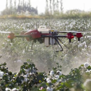
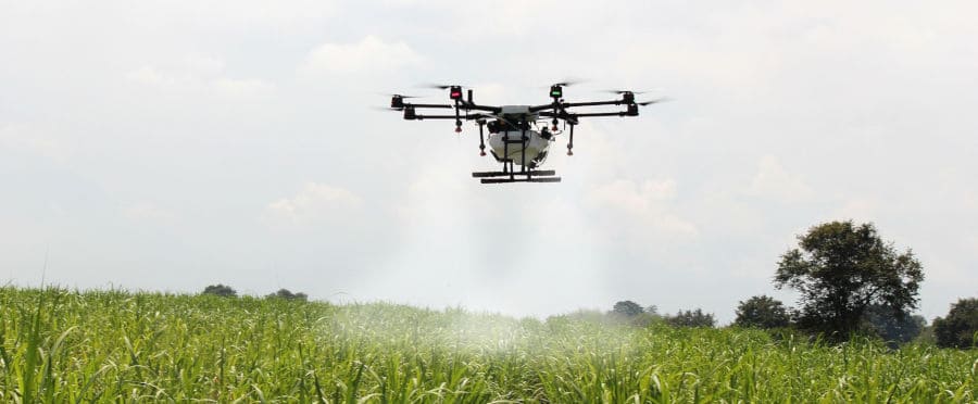
3. Fertilize with drones
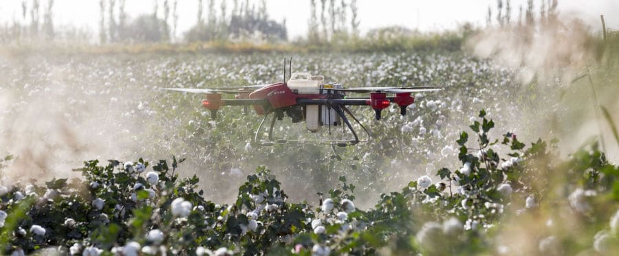
After sowing the plant comes fertilization and treatment with pesticides.
Often, fertilizers or pesticides are still sprayed by hand. This cannot guarantee that all parts of all plants are covered, you must often spray twice, and it’s very time-consuming.
Large areas are brewed with machines, which damages the soil, and lanes are necessary, which reduce the possible acreage. The spraying of the fertilizer or pesticides with machines is much more uniform than by hand.
Drones are faster and do not damage the ground. For this purpose, drones are equipped with a tank (about 10–30kg). The agent is pumped into the individual nozzles. The fertilizer or pesticide is then distributed in a pulse during the overflight. The drone’s route is programmed to fly over all parts of the field at low altitudes, which is necessary to minimize the loss from the wind. In addition to a GPS signal, the drone is equipped with a radar system that determines the exact distance from the ground and controls the drone accordingly.
Depending on the application, the tank size is currently the limiting factor. The drone must fly back to the starting point relatively often to receive new fertilizer. The payload of drones will increase in the future, making this already efficient method even more efficient.
4. Distribute bait or natural predators with drones
Drones are suitable not only for spraying pesticides but also for distributing bait or beneficial insects for pest control.
One example is the European corn borer (Ostrinia nubilalis). The caterpillars of this small butterfly eat the pith of the maize stem and damage about 4% of the annual corn crop worldwide.
Parasitic wasps (Ichneumonidae) serve as an antidote. They are thrown off the drone in small balls across the field in the same way individual seeds are sown. The drone flies at 7m/sec at about a 15m height in a well-defined route across the field. Every seven meters, a ball of parasitic wasps is dropped. The row spacing is about 14 meters.
In a single ball, there are about 100 parasitic wasps, and for one hectare, 80 balls are needed.
When the beneficial insect is used, experts predict it achieves the best possible effect. After 10–14 days, this process is repeated in order to completely combat the European corn borer.
Multispectral analysis of fields with drones
The field of optical data evaluation has experienced a massive boom in recent years. Based on autonomous driving, computers can use cameras to detect objects, roads, and even facial expressions. These developments apply not only to the visible range of light but also to the entire light spectrum, from ultraviolet to infrared.
These developments are also used for drones in forestry and agriculture. There are completely new possibilities to monitor usable areas and optimize them.
5. Weed detection with drones
Drone weed detection takes place via images in the range of visible light (430nm–780nm) of the electromagnetic spectrum. The drone flies over the field and takes georeferenced images. This means that each image can be assigned precisely to a position in the field, which creates a large, composite, aerial view of the agricultural area.
Then, the images are analyzed. A computer uses a trained algorithm to distinguish whether the image shows soil, weeds, or crops. From this, a map can be created showing where, what type, and how intensely plant protection has to be carried out.
This complex process saves fertilizer and pesticide and, at the same time, helps protect the plants and agricultural land.
6. Inspect irrigation with drones
Drones can also be used for optimal irrigation. It’s less about the irrigation itself and more about detecting dry spots and avoiding overwatering.
Fields are not even with consistent soil conditions. Some places in the field are drier and water can drain easily, and in other places, water collects and has no way to penetrate evenly into the ground.
This leads to uneven plant growth or crop failure in extreme weather conditions such as drought.
Drones offer the possibility to measure these different soil conditions. Here, a thermal image of the agricultural area is used, which is georeferenced in the same way as with weed detection. The resulting composite thermal image of the usable area makes it possible to create a map of the degree of irrigation of the usable area.
This process evaluates the heat of the field. Dry areas are warmer and damp areas colder. Depending on the option, additional irrigation systems can be installed or specific drainage dug.
7. Detection of mold infestation with drones
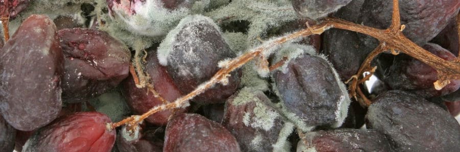
Mold fungus is a big problem, especially in viticulture: 60% of all mold fungi are used in Europe for viticulture. It makes sense to recognize mold infestation as quickly as possible to target your attack against it.
Every plant reflects light in a very specific way. If a plant is attacked by mold, its light behavior also changes. This applies to a mold infestation not only for visible light but also, especially in the initial stage, in the infrared range. This phenomenon is used to detect the mold early, before the first features appear to the human eye.
The German Aerospace Center (DLR) uses the same effect, using a special laser to irradiate the plants and then absorb the reflected light. By doing so, they hope to get even better pictures of the agricultural areas and the plants.
The drone then picks up a georeferenced image of the fields and creates a composite map. The analysis of the individual light spectra shows either the difference between the healthy and diseased plants of the agricultural area or databases about which type of mold it is.
The knowledge gained in connection with the map can then be used to treat the field with a drone targeting the areas of mold infestation with a pesticide.
The early detection of mold makes it possible to prevent spreading but requires regular observation of agricultural land. Depending on the mold fungus species, the process should be carried out in a cycle ranging from a few days to a few weeks.
8. Detection of pest infestation with drones
The last major topic of the multispectral analysis is the detection of pests in plants. The wood industry in particular is plagued by bark beetle larvae, which destroy the transport routes of trees and thus prevent water transport. In tree needles, the chlorophyll and water content changes. Both lead to a change in the light reflection behavior.
When infested, trees die within eight to ten weeks, and the larvae spread to neighboring trees. Through a multispectral analysis, an infestation can be detected after three to four weeks, offering the forest owner the possibility to prevent the spread of the bark beetle early through a targeted removal of the infested trees.
Firms like Festmeter fly drones over observable forests. The drones take georeferenced images with a high-resolution infrared camera and combine them to form a map of the usable area.
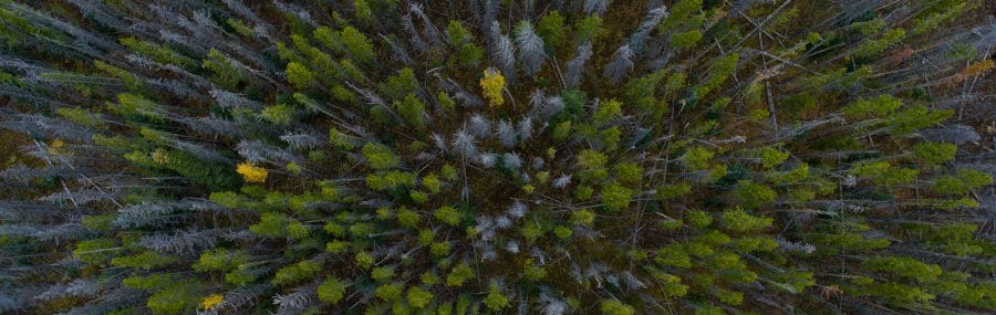
The special part is the analysis. For this purpose, several overflights are necessary. Reference pictures are taken at the beginning of the season. At the critical times of the attack, images are taken at regular intervals.
The algorithm of the subsequent analysis recognizes the individual trees and examines their light reflection behavior over time. Databases and machine-learning algorithms can then be used to detect infected trees.
In the case of bark beetle infestations, the GPS coordinates of the infested trees are displayed.
9. Expelling birds using drones
The problems of agriculture include not only mold and larvae but also birds. It’s not the eaten fruits that are the problem but the slightly damaged fruits. The dents and scratches of bird claws are the germs of bacteria and mold.
Most birds are scared off with scarecrows or speakers blaring the sounds of birds of prey. However, many birds realize that the artificial birds of prey are not moving, which minimizes the success of these loudspeakers.
Drones can be used as scarecrows not only at airports but also in agriculture and forestry.
The company Bird-X combines different types of expulsion using drones with loudspeakers. Flying over the fields and radiating the sounds of natural enemies is time-consuming but effective to expel birds.
10. Rescue game before harvesting with drones
In Germany alone, about 500,000 wild animals die each year in agriculture. Fawns in particular have no escape instinct in their first four weeks, which is why they crouch on the ground in the case of danger.
Dead animals are dangerous, especially when making hay bales. Through the carcasses, diseases are passed on to other animals. It’s already damaging to a farmer to notice animal remains while feeding livestock and having to dispose of the hay bale.
The ethical reasons of animal welfare also speak for rescuing wild animals before the harvest. With the help of thermal imaging cameras, drones can fly over agricultural areas quickly and efficiently. If they find an animal, they can scare it away or bring it to safety.
In Europe, clubs that offer this service for free have formed. The only drawback is that if an animal is found, people have to go through the field to carry the animal out.
11. Counting animals with the help of drones
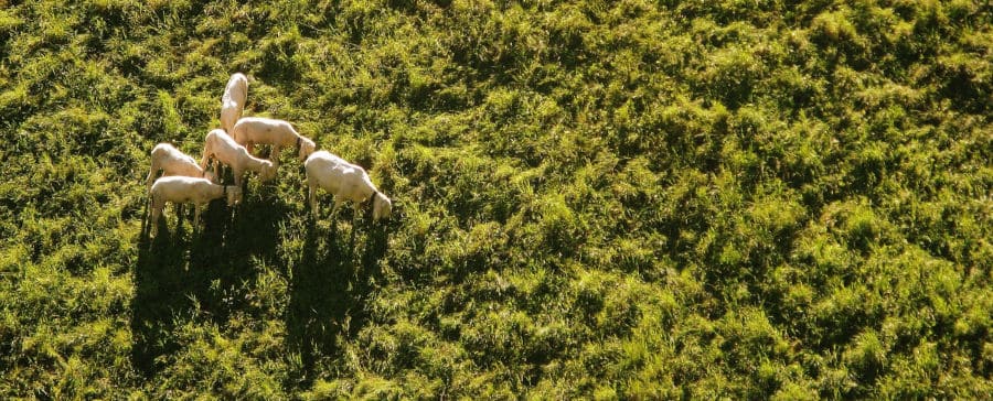
One of the last applications of my summary is counting animals with the help of drones. Drones fly over pastures and take pictures. An algorithm then counts the animals.
Particularly with large or poorly accessible pastures, such as alpine pastures, this method is very helpful.
In addition, sick animals can be identified, and if necessary, help can be obtained.
In order not to unnecessarily disturb the animals, the drone should fly as high as possible over the pasture, which requires a high-resolution camera.
Summary and Outlook
The applications of drones in agriculture and forestry are versatile and demanding. Although some applications are not yet profitable, over time, technology will improve, and drones will become cheaper to manufacture. Legislation will also find rules for flying outside of sight, which will allow for the legal execution of this technology. All in all, the trend is toward efficiency and security, which in any case represents the monetary value of this drone application.
I hope this compilation of the applications of drones in agriculture and forestry could provide a small overview.